
I wandered lonely as a Point Cloud
In this post, we explain what point clouds are and why they’re becoming an increasingly important part of day to day life across a multitude of industries.
What are Point Clouds?
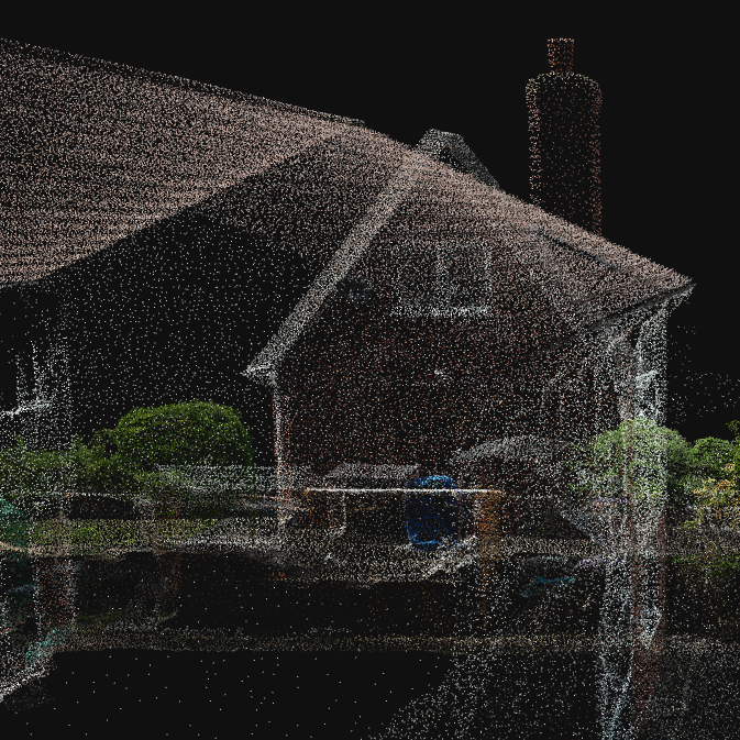
Put simply, a point cloud is a collection of data points in a three-dimensional space.
Let’s start with something simple like a seashell. If we take measurements of one hundred different points on the shell’s surface we can then plot each of those points in a virtual space to build a simple model. If we increase the number of measurements then the model becomes more detailed.
Now consider a much more complicated structure, such as the inside of your kitchen. Think of all the large surfaces such as walls, ceilings, floors, tables and worktops. Then add in all the objects on them such as plates, cups and bowls, to name a few. Everything visible in the room has surfaces that need to be captured and represented as points, requiring us to scale up to millions.
Collecting and storing all of these points together gives us a point cloud, which can then be saved as a file. A point cloud then gives us a detailed and accurate representation of an object or a complex structure. Each point can also have associated meta-information, such as colour or intensity.
How do we generate Point Clouds?
There are two common ways of generating a point cloud – Lidar or Photogrammetry.
Lidar (Light Detection and Ranging) uses pulses of light to measure the distance to an object. Your smartphone may have a Lidar sensor built-in, for example.
For a more in-depth explanation of LiDAR, check out A Complete Guide to LiDAR on the GIS Geography website.
Photogrammetry works by analysing hundreds or thousands of 2D images to determine where the points are in the three-dimensional space. These images are typically taken with a regular RGB (Red, Green and Blue) sensor camera.
To read more about photogrammetry, check out our other blog posts.
What applications are there for Point Clouds?
Whilst the concept of a point cloud is relatively simple, they hold immense potential across a variety of industries. The following is by no means comprehensive, but tries to highlight some everyday uses for point clouds that impact our lives.
Architecture and Construction
The work of architects, engineers and construction professionals has been revolutionised by point cloud technology. Being able to capture the as-built state of structures as a point cloud enables accurate modelling and analysis.
This not only aids the design process for renovation or extension work, but also facilitates clash detection analysis. Making sure that new elements will fit seamlessly into existing structures and avoiding costly on-site corrections.
Surveying and Mapping
Traditional surveying methods can be time-consuming and labour-intensive. Point clouds offer a more efficient solution by rapidly capturing accurate topographical and geographical data. Another benefit is the ability to capture many more data points that can then be represented as a point cloud.
Once captured, accurate measurements then can be obtained from the point cloud. This is especially valuable in urban planning, land development, and environmental monitoring.
Cultural Heritage and Preservation
Conservationists meticulously document historical sites and artefacts as part of preservation efforts. These days, this will involve the creation of digital replicas recorded with a high degree of precision. Not only does this help in our understanding and aid restoration, but also provides researchers with an immersive way to explore our heritage.
A point cloud acts as a permanent record of the current state of a site. This can be compared against any previous or future scans of the same location. This allows them to check for any deterioration and helps determine if and where they need to do any remedial work.
Manufacturing and Quality Control
Scanning a physical object to create a point cloud allows the object to be compared alongside its digital design for reference. If the manufacturing process has introduced any deviations from the reference, then these can be picked up and the object rejected to ensure consistency. This greatly helps improve overall quality assurance.
Autonomous Vehicles
Some manufacturers of self-driving cars use Lidar generated point clouds to build up a model of the vehicle’s surroundings for the on-board computer to interpret. Training the computers to correctly interpret this data and then consistently determine the right course of action is the hard part.