
Terrain Surveys
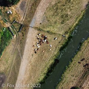 Our Aerial Terrain Surveys cover larger areas of land to create two- and three-dimensional maps of your site. These maps show contours and terrain as well as man-made features such as buildings, ditches and boundaries.
Traditional methods of surveying from the ground can be both time-consuming and expensive. In some harsher environments it may not be safe for people to access them at all. This is where aerial surveys become a game-changer.
We use professional drones equipped with the latest RTK enhanced GPS technology. This means that every image taken from the air is accurately geotagged with the position at which it was taken.


Along with a high-quality lens and a mechanical shutter, this allows important features to be located with accuracy and measurements taken with confidence.
Post image capture, our digital team will use the latest photogrammetry software to generate a range of digital assets to suit the needs of your project. Including high resolution orthophotos, digital terrain models, point clouds and 3D models.
These digital media can easily be shared with your in-house team or external contractors to provide greater insight into your site, which in turn will help guide your strategic planning.
If you would like more information on our aerial terrain surveys then we’d love to hear from you. Use our contact form to get in touch with us.